
News · Entopizo Pro
Sea charts and a shallow water alarm in Entopizo Pro
Entopizo · November 8, 2026
The live map of Entopizo Pro now speaks the language of the sea: lights, buoys, harbours and marinas, the depth of the water and its contours. And for every boat with a GPS tracker, a new alarm warns before it heads into shallow water.
Sea marks
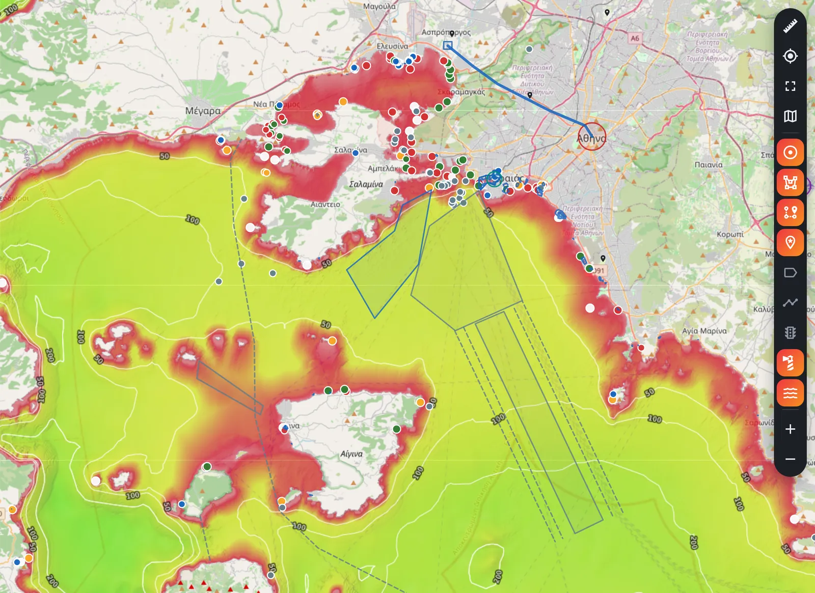
Every light, buoy and harbour, with its details
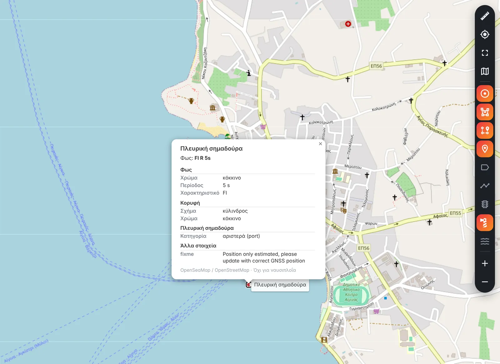
Turn on «Sea marks» and the map shows the lights, buoys, beacons, harbours, marinas and fairways of Greece and the whole Mediterranean. Tap one and its card opens: what it is, its light in the notation of nautical charts (for example Fl R 5s), its colour, its topmark and every other detail the data holds.
- Our own copy of OpenSeaMap’s data, refreshed once a month
- From zoom 9 on a computer, from zoom 10 on a phone
- A card for every mark, with all its details
Sea depths
The depth of the water, wherever you tap
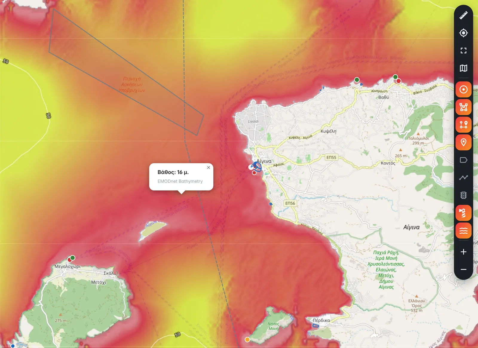
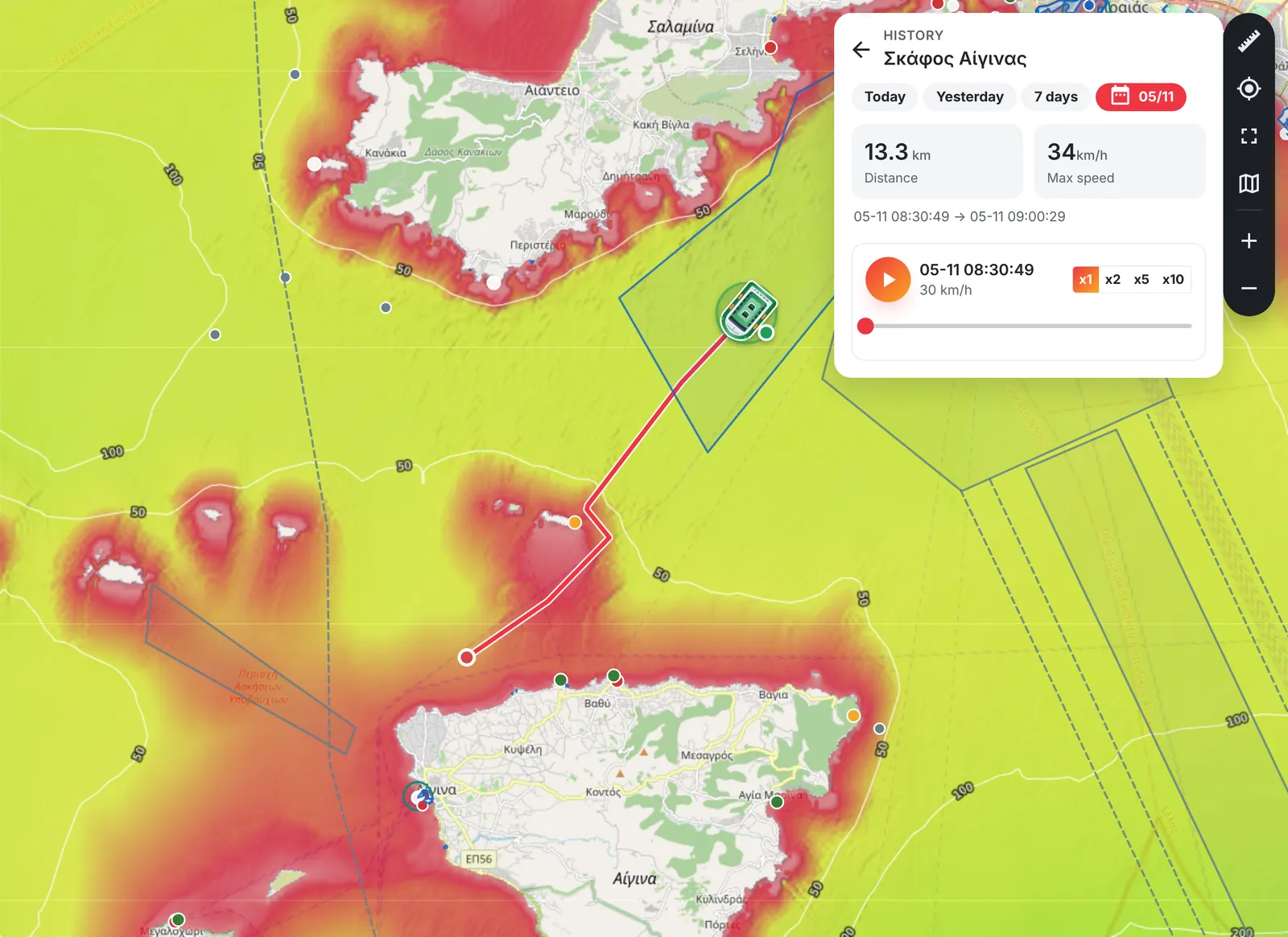
Turn on «Sea depths» and the sea takes the colour of its depth, with depth contours and the names of seas and seabed features on top. Tap any point at sea and Entopizo Pro tells you the depth there, from EMODnet Bathymetry, the European Union’s open map of the seabed.
- Colour by depth and depth contours
- The depth at a tap, and the seabed feature nearby
- Both layers are off until you switch them on
New alarm
Shallow water ahead
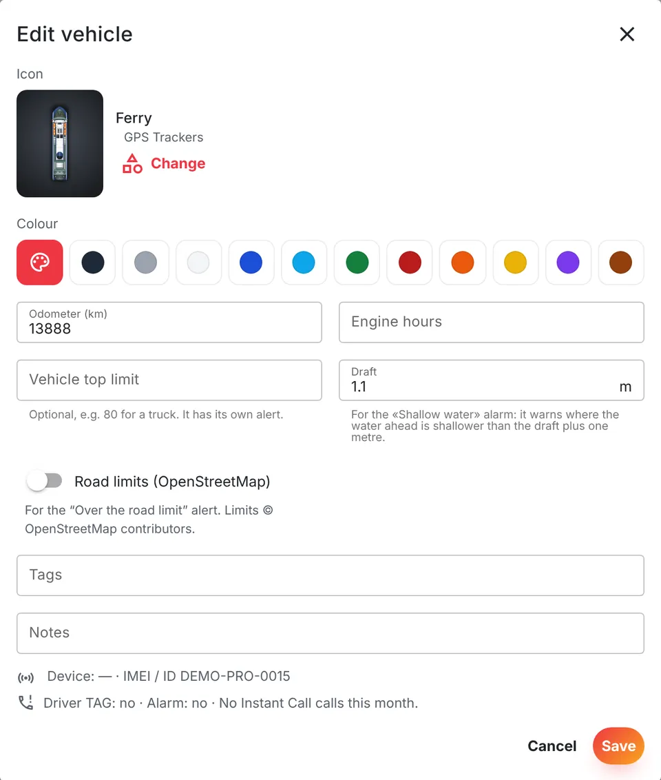
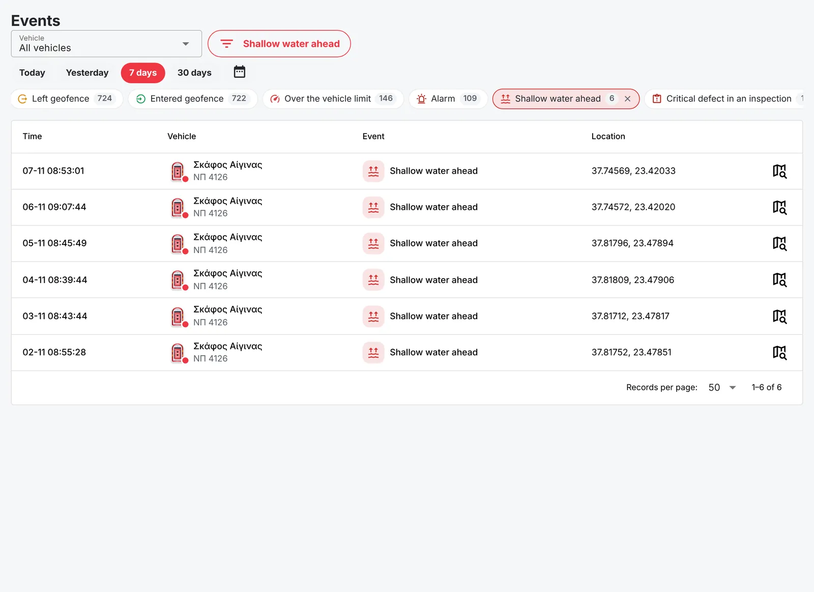
Give each boat its draft, and Entopizo Pro watches the water in front of it. When a boat under way (2 knots or more) heads into water shallower than its draft plus one metre, or onto a charted rock, wreck or obstruction, within the distance it covers in the next minute (at least 100 m), you get the alarm «Shallow water ahead» — and again every minute while the boat keeps that course.
- The draft is set per boat, so the alarm fits each one
- Depths from our copy of EMODnet’s data for Greece and the Mediterranean
- An alarm rule can also switch an output of the tracker on for 5 to 600 seconds, for example a siren on board
- It appears in the events, with a sound, like every other alarm
The sea charts of Entopizo Pro are an aid for monitoring your boats, not a navigation chart. They do not replace the official charts and equipment of the vessel.
Per boat
Set the draft of each boat
In the boat’s details, enter its draft in metres: how deep it sits in the water. Entopizo Pro then warns where the water ahead is shallower than that draft plus one metre.
Events
Every alarm, with the time and the point
Each «Shallow water ahead» is kept in the events, with the boat, the time and the position. Open one on the map and replay the trip with the sea depths around it.
For boats, yachts and rental fleets
The sea layers are part of Entopizo Pro. To see how a GPS tracker protects a boat at anchor or in the marina, read our guide to GPS trackers for boats, or see the trackers for boats and vessels. More about the platform on the Entopizo Pro page.
Official Teltonika Distributor & Gold Partner in Greece · ISO 9001:2015 · ISO 27001:2022
Petros Simeonidis Security Services Private Company General Partnership · VAT No. 800439395 · Tax Office: KEFODE Attikis · G.E.MI. No. 122657807000
© 2026 Entopizo. All rights reserved.
Share your experience with Entopizo
Your feedback helps us improve our GPS tracking, vehicle security and telematics services, while helping future customers choose with confidence.
We use cookies for analytics and advertising (Google Tag Manager, Meta pixel) only if you agree. Necessary cookies are always on. Without consent Google receives only anonymous signals, without cookies. Privacy policy